
Timor-Leste Annual Area Burnt by Wildfires 2026: 22,668 hectares
Timor-Leste's annual area burnt by wildfires in 2026 is 22,668 hectares, up 94.9% from 2025. It ranks #102 of 227 countries.
Annual area burnt by wildfires measures the total land affected by wildfires each year in hectares.
Source (2026): Annual area burnt by wildfires
Where Timor-Leste ranks (2026)
#102 of 227- #100
 Turkmenistan24,303 hectares
- #101
 Eswatini24,267 hectares
- #102
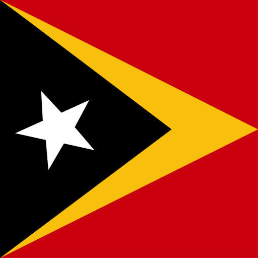 Timor-Leste22,668 hectares
- #103
 New Zealand22,159 hectares
- #104
 Sri Lanka20,210 hectares
Annual Area Burnt by Wildfires over time
| Year | Value | Change | % Change | Actions |
|---|---|---|---|---|
| 2026 | 22.67K hectares | +11.04K hectares | +94.86% | |
| 2025 | 11.63K hectares | 5.16K hectares | -30.71% | |
| 2024 | 16.79K hectares | 51.94K hectares | -75.57% | |
| 2023 | 68.72K hectares | +62.75K hectares | +1050.77% | |
| 2022 | 5.97K hectares | 6.04K hectares | -50.29% | |
| 2021 | 12.01K hectares | 30.06K hectares | -71.44% | |
| 2020 | 42.07K hectares | 44.38K hectares | -51.33% | |
| 2019 | 86.44K hectares | 7.64K hectares | -8.12% | |
| 2018 | 94.09K hectares | +35.74K hectares | +61.27% | |
| 2017 | 58.34K hectares | +51.32K hectares | +730.60% | |
| 2016 | 7.02K hectares | 47.14K hectares | -87.03% | |
| 2015 | 54.17K hectares | 53.82K hectares | -49.84% | |
| 2014 | 107.98K hectares | +90.01K hectares | +500.78% | |
| 2013 | 17.97K hectares | 47.56K hectares | -72.57% | |
| 2012 | 65.53K hectares | — | — |
Cite this page
Geo Factbook. (n.d.). Timor-Leste: Annual Area Burnt by Wildfires. Retrieved November 16, 2026, from https://geofactbook.com/countries/timor-leste/annual-area-burnt-by-wildfires
The figures on this page come from Annual area burnt by wildfires | Global Wildfire Information System via Our World in Data. For academic work, cite the original source as well.
Frequently Asked Questions About Timor-Leste Annual Area Burnt by Wildfires
What is Timor-Leste's annual area burnt by wildfires in 2026?▾
Timor-Leste's annual area burnt by wildfires is 22,668 hectares in 2026, according to Annual area burnt by wildfires | Global Wildfire Information System via Our World in Data.
Is Timor-Leste's annual area burnt by wildfires increasing or decreasing?▾
Timor-Leste's annual area burnt by wildfires rose by 94.9% from 2025 (11,633 hectares) to 2026 (22,668 hectares). Over the past decade (2016–2026) it rose by 222.7%.
How does Timor-Leste rank for annual area burnt by wildfires?▾
In 2026, Timor-Leste has the 102nd highest annual area burnt by wildfires out of 227 countries with data.
What was Timor-Leste's annual area burnt by wildfires in 2012?▾
In 2012, Timor-Leste's annual area burnt by wildfires was 65,535 hectares. By 2026 it fell by 65.4%.
Explore additional statistical insights
Electricity from Other Renewables in Timor-Leste
Electricity from other renewables measures alternative energy sources. Explore country comparisons, rankings, and historical trends with interactive maps.
Refined Petroleum Products Exports in Timor-Leste
Refined petroleum products exports reflect a country's economic strength. Compare nations, explore rankings, and view interactive maps.
Refined Petroleum Products Production in Timor-Leste
Refined Petroleum Products Production data reveals insights into global energy trends. Compare countries and explore interactive maps and rankings.
Refined Petroleum Products Imports in Timor-Leste
Refined petroleum products imports indicate a country's energy demand. Explore rankings, compare nations, and view interactive maps.
Tomato Yield per Hectare in Timor-Leste
Tomato yield per hectare indicates the average amount of tomatoes produced on one hectare of land.
Revenue from Forest Resources in Timor-Leste
Revenue from forest resources reveals economic contributions by country. Explore rankings, compare nations, and view interactive maps.